The map, wrote Sylvia Wynter, is a function. And therefore a function can be mapped. Cartography has never been neutral and its function is always the representation of an interest. It is both domination and subversion. Colonial and anti-colonial. Personal and impersonal. It has everything to do with geography and absolutely nothing to do with geography. The map is always, always, mutable.
Mapping first creates and then imposes order. The earth can be mapped, the heavens can be mapped, the body can be mapped. Sometimes the map decides who has the right to live and to die. Where citizens’ rights begin and end. Who has reproductive rights and who does not. And despite all this, today, the map as a symbol of geographic territory is the quintessential map. Nevermind, as within such maps lie other maps.
There is, for example, today’s colonial map of the US. This map functions to unify territories for the imperialist US state to perform as a secular God. The state in turn is represented through the police, who impose the rules of this diety. This imposition is crafted through violence. When the function is state violence, what do the cartographers create?
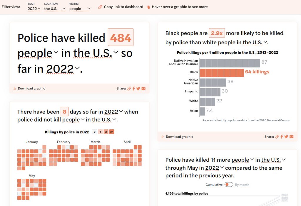
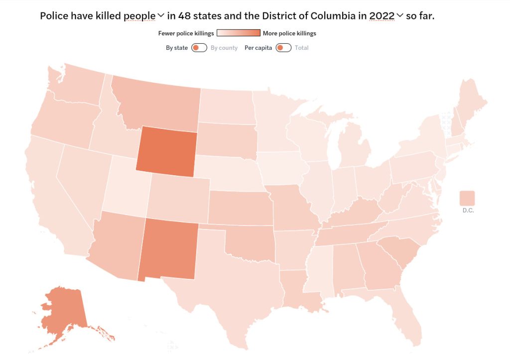
Some create the imperialist territorial maps we all know, which historicise the displacement of indigenous lands. However, some cartographers create sites like Mapping Police Violence, a digital map that has a clearly different function: to track and localise how the imperialist US state, through the police, murder those within its cartographic domain. The creators of the project tell us that, “Law enforcement agencies and the government fail to provide accurate numbers on the number of lives taken at the hands of police”. And as such, they developed this map, which is updated regularly. As the data for the map also takes in to account the ethnicity of those killed, it also maps the racialised system of mass murder undertaken by the state. Or, in other words, whose lives have ontological value within the cartographic borders of the colonial US.
The state functions through violence, everywhere, all the time. Cartographers in Buenos Aires know this too. The Mapa de la Policia does not just limit itself to police murders, but the many other forms of police violence. For now, just localised just to Argentina’s capital city, this interactive map functions by allowing people to demarcate incidences of police abuse, including evidence if there is any. As the map alone cannot help the oppressed, the website designers also have extensive resources to assist the victims of police violence.
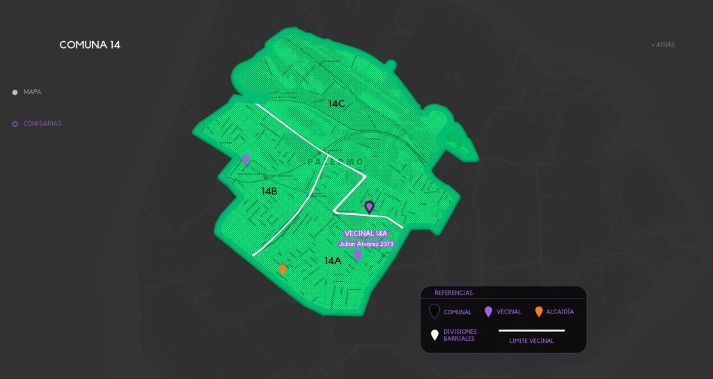
The hyper-localised mapping of this violence—one can even see which street the incident took place on—creates a new geography of the state. Borders that delineate neighbourhoods are no longer simply administrative (if they ever were) but now narrate how particular neighbourhoods, their populations and their property, are managed through state violence. The Mapa de la Policia, therefore, functions to eradicate domestic borders: violence bleeds across the cartographised city, except for those neighbourhoods where the state does not feel threatened by its denizens.
When the poor rebel—particularly when they reclaim property—the state answers with force. In 2019, within the colonial map of Colombia, it was mainly the poor, the disenfranchised, the racialised, who came on to the street to paralyse the state. As such, the state brought violence upon the people to control them. This too was mapped.
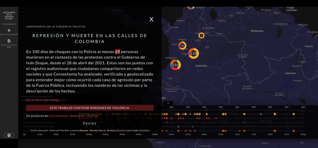
While this map only shows the function of the police/state between April and August 2021, it is hyper-localised, paralleling the Mapa de la Policia in Buenos Aires and showing where forms of police abuse (including shots fired, murder, injuries, those ‘disappeared’, and other forms of violence) took place at a street level. That is, at the level of our everyday lives, where we walk, work, love, breath. These maps all function together: violence, violence, violence! – at the hands of a common entity. The cartographised borders matter not, the violence is the same.
The dominating function of territorial maps has always been challenged by the oppressed. By indigenous groups. By Roma. By migrants. By the anti-colonial struggles of the twentieth century. Indian independence movements even created their own maps of India to animate the resistance.
The three maps above are also resistance. Their function—as an interest—is to undermine the police. They situate and archive police abuse within their own geographic locality where it has the chance to become intimately more relatable, while conjointly linking together the borderless, universal system of oppression. As digital-interactive maps, they even challenge our everyday use of popular web mapping technology like Google and Apple Maps. What if our travel apps informed us of state violence on our streets, rather than just shop opening times and tourist hotspots? Would some begin to think differently about the function of the police within their territories?
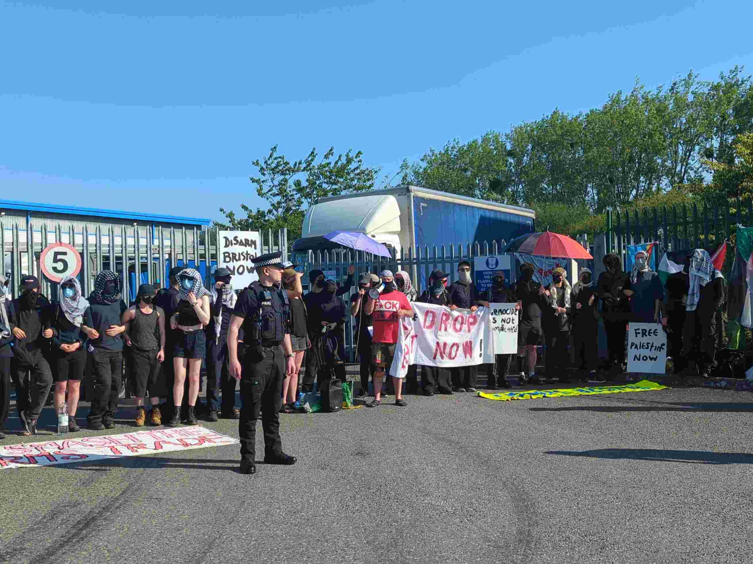
We need more of these maps, preferably open-source. In imperialist Britain alone, where the impudent Wayne Couzens Klan (more commonly known as the Metropolitan Police) recently murdered 24-year-old drill artist, Chris Kaba, it was revealed in early 2022 that over 650 children were strip-searched by the state in just a two-year period. This from the same police force that has been accused by hundreds, potentially thousands, of citizens of sexual abuse in the last decade; who have executed numerous more like Chris Kaba at will; who have deported (or attempted to) countless more humans deemed unworthy of citizenship. All this potentially forgotten unless it is coherently mapped. Not just in imperialist Britain, but in every country, in every city, in every town.
Rohan Rice is adrift in the maelstrom. Find his work at https://smokesignals.me
Image: “Mapping Police Violence,” Campaign Zero, [8.11.22], https://mappingpoliceviolence.org/